
1. Introduction to Navigation Fundamentals
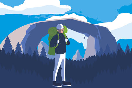
Heading out into the American wilderness is an adventure that calls for more than just enthusiasm and a good pair of boots. Whether you’re hiking in the Rockies, backpacking through Yosemite, or exploring the forests of the Pacific Northwest, having solid navigation skills is essential for your safety and confidence. Getting lost isn’t just inconvenient—it can quickly become dangerous, especially as cell service disappears and landmarks become harder to recognize.
Let’s kick off with a quick refresher on the two primary tools most folks rely on: the compass and GPS device. Each has its strengths and quirks, and knowing how to use both gives you options when things get tricky.
Why Navigation Skills Matter in US Wilderness
| Reason | Real-World Impact |
|---|---|
| Lack of cell signal | No way to call for help or look up maps online |
| Changing weather conditions | Poor visibility or landmarks obscured by fog/snow |
| Vast, unfamiliar terrain | Easy to wander off trail or misjudge distance |
| Wildlife encounters/accidents | You may need to reroute quickly and safely |
Compass Basics—The Trusty Standby
- Orienting: Use your compass to find North and align your map accordingly.
- Bearing: Set a bearing to keep heading in your chosen direction, even if you can’t see a trail.
- No Batteries Needed: A compass won’t fail due to dead batteries or bad signal.
GPS Devices—Your Digital Co-Pilot
- Pinpoint Accuracy: Modern GPS units can show your location within a few feet.
- Route Tracking: Save waypoints, track your hike, and find your way back if needed.
- Cultural Note: In many US national parks, rangers recommend carrying both GPS and a map/compass—technology is great, but it’s not foolproof!
Troubleshooting Mindset: Gear Up for Problem-Solving
The key takeaway? Mastering both traditional and digital navigation tools helps you avoid common mistakes, troubleshoot errors on the fly, and ultimately enjoy your time outdoors with greater peace of mind. In the next sections, we’ll dig deeper into common navigation pitfalls and practical fixes tailored for America’s diverse wild spaces.
2. Common Compass Mistakes in US Terrain
Understanding Typical Compass Errors
Even experienced hikers can get tripped up by compass mistakes, especially when trekking through the diverse landscapes of the United States. Here are some common pitfalls and simple ways to avoid them so you can stay on course.
Magnetic Declination Mix-Ups
The magnetic north isn’t the same as true north—and this difference is called magnetic declination. In the US, declination varies widely depending on where you’re hiking. Not accounting for it can put you miles off your intended path.
| Region | Approximate Declination | What To Do |
|---|---|---|
| West Coast (e.g., California) | +10° East | Add 10° to your compass reading |
| Rocky Mountains | 0° (Varies) | Check local maps for exact value |
| East Coast (e.g., Maine) | -15° West | Subtract 15° from your compass reading |
Always check a current map or a reliable online source for the latest declination where you’ll be hiking, and set your compass accordingly.
Metal Interference: Vehicles, Phones, and More
Your compass needle points to magnetic north—unless it’s confused by nearby metal or electronics. In the US, trailheads often have cars, cell phones, and even old fence posts that can throw off your compass. Step at least 10-15 feet away from any vehicle or large metal object before taking a reading. Also, stash your phone in your backpack while navigating to avoid interference.
Misreading Topographic Maps with Your Compass
Many hikers make mistakes when lining up their compass with a topo map:
- Forgetting to orient the map to north before using the compass.
- Mismatching map scales or failing to connect landmarks accurately.
- Confusing contour lines and mistaking valleys for ridges.
Simplify things by always laying your map on flat ground, aligning it with visible landmarks, and double-checking that north on the map matches north in the real world.
Quick Tips to Avoid Compass Pitfalls
- Practice adjusting for declination before hitting the trail.
- Avoid taking compass readings near cars, steel bridges, or power lines.
- Refresh your topo map skills before venturing into unfamiliar terrain.
- If in doubt, stop and recheck both your bearing and location rather than pushing ahead blindly.
Troubleshooting these common compass errors will help keep you oriented and safe wherever your adventures take you in the American wilderness.
3. GPS Challenges Unique to U.S. Wilderness
Understanding the Lay of the Land
When youre out hiking or camping in the U.S., GPS can be a lifesaver — but its not always perfect. In different parts of the country, certain landscapes and conditions can throw your device for a loop. Here are some real-world challenges you might run into while using GPS in American wilderness areas.
Where GPS Can Struggle
| Location Example | Common Issue | Why It Happens |
|---|---|---|
| Pacific Northwest Forests | Signal Loss | Thick tree canopy blocks satellite signals, making your GPS less accurate or completely unresponsive. |
| The Grand Canyon & Other Canyons | Weak/No Signal | Steep canyon walls block signals from satellites, especially at the bottom of deep valleys. |
| Appalachian Mountains | Spotty Reception | Rolling terrain and dense woods combine to disrupt signal strength and accuracy. |
| Desert Southwest (e.g., Utah) | Overheating/Battery Drain | Extreme temperatures and wide-open spaces can cause devices to overheat or use more power searching for satellites. |
User Interface Confusion: Not Just a Tech Problem
If youve ever tried to set waypoints or navigate menus on your GPS unit after a long day on trail, you know it can feel like solving a puzzle. Many hikers report getting tripped up by:
- Bizarre Menu Structures: Each brand has its own way of organizing settings, which might not be intuitive if you’re used to smartphones.
- Mislabeled Features: Some U.S.-sold models use terms that don’t quite match common navigation language or hiking slang.
- No Clear “Back” Button: Getting stuck in sub-menus without an obvious exit is surprisingly common.
Troubleshooting Quick Tip Box:
- If lost in the menu, try holding down the “power” or “menu” button for 2–3 seconds; many devices reset to the main screen this way.
- If possible, download the manual PDF to your phone for quick reference (many brands offer them free online).
Battery Management for Long Hikes
The United States has epic trails like the Pacific Crest Trail and Appalachian Trail, where resupplying batteries isn’t always easy. Here’s how different GPS setups compare when it comes to power management:
| Device Type | Average Battery Life | Best Practices for US Wilderness Trips |
|---|---|---|
| Handheld GPS Unit (AA batteries) | 10-20 hours (replaceable) | Carry extra batteries; lithium AAs work best in cold/heat. |
| GPS Watch/Fitness Tracker | 12-40 hours (rechargeable) | Pack a lightweight power bank and charge during daylight breaks. |
| Smartphone with GPS Apps | 6-12 hours (with screen use) | Keep on airplane mode except when needed; bring a backup battery pack. |
Packing Note:
- Lithium batteries handle temperature extremes better than alkaline — great for both winter in Montana and summer in Arizona!
A Few More U.S.-Specific Tips:
- If hiking near military bases (especially in the West), you might notice weird signal drops—some regions do temporary jamming for training exercises.
- Parks like Yellowstone and Yosemite have large “dead zones” with no cell service; always download maps offline before heading out.
- Certain backcountry permits require carrying a physical map even if you have a GPS—double-check local rules!
Navigating with GPS in America’s wild places takes a bit of planning, but knowing these pitfalls helps you stay found instead of frustrated!
4. Mixing Digital and Analog: When to Trust Your Tools
How to Cross-Verify Between Compass and GPS Readings
Out in the US wilderness, your smartphone or handheld GPS feels like a lifeline—but what happens when batteries die or you lose signal? That’s where your compass and map step up. Here’s how to cross-check both tools so you don’t get turned around:
- Take a GPS reading: Get your current coordinates and note your heading.
- Check with your compass: Take a bearing toward your next landmark or trail junction.
- Compare directions: Do both tools agree on which way is north or where the trail bends? If not, pause and double-check your work—sometimes metal objects, dead batteries, or even thick clouds can mess with accuracy.
Combining Traditional Skills with Tech
The best navigators blend old-school skills with digital convenience. It’s all about using the right tool at the right time. Here’s a quick cheat sheet for common situations:
| Scenario | What to Use First | Why |
|---|---|---|
| Dense forest, poor GPS signal | Compass & Map | Trees block satellites; analog wins for reliable bearings. |
| Open desert or plains | GPS Device | No landmarks; GPS pinpoints exact location fast. |
| Foggy/rainy conditions | Compass (check calibration) | Clouds can interfere with satellite signals; verify compass isn’t affected by nearby metal. |
| Batteries running low | Compass & Paper Map | No power needed; tech backup if you need a quick coordinate fix. |
| Navigating to a specific waypoint (like a campsite) | Both (Cross-verify) | Follow the GPS track but check compass bearing to avoid errors from potential GPS drift. |
Deciding Which Tool to Rely On
Consider the Weather and Terrain
- If it’s cloudy, raining, or snowing: Rely more on your compass—satellites may be unreliable.
- If you’re in open country: GPS shines here, but always carry a map as backup.
- If you’re deep in canyons or under heavy tree cover: Expect spotty GPS reception; trust your compass and use terrain features on your map.
Assess Equipment Reliability
- Batteries low? Power down devices and switch to analog navigation.
- Dropped your compass? Double-check for damage or magnetization issues before trusting it completely.
- If anything seems off (weird readings, confusion): Pause, take a breath, and use both tools together to re-confirm your position and direction. Don’t ignore gut feelings if things aren’t matching up!
Navigational Confidence Comes from Practice
The more you practice switching between GPS and compass navigation, the faster you’ll notice when something’s wrong. In the US backcountry, knowing when—and how—to trust your gear can mean the difference between getting home safe or spending an unexpected night under the stars. Don’t just rely on one tool—learn both, cross-verify often, and stay sharp out there!
5. American Environmental Hazards Impacting Navigation
Understanding the Real-World Challenges
Navigating the American wilderness isn’t just about knowing how to read a compass or operate a GPS. The U.S. landscape throws some unique curveballs your way—think wild weather swings, weird magnetic zones, and even surprise trail closures. Here’s what you need to watch out for, and how to stay ahead of trouble.
Common US Hazards That Mess with Your Navigation
| Hazard | Where It Happens | Why Its a Problem | How to Prepare |
|---|---|---|---|
| Extreme Weather Swings | Rockies, Sierras, Appalachians | Sudden storms or temperature drops can make landmarks disappear and devices glitchy | Check hourly forecasts, pack layers & rain gear, carry backup paper maps |
| Local Magnetic Anomalies | Black Hills (SD), Yellowstone (WY), parts of Nevada & New Mexico | Compass readings may go wild—needle drifts or spins unpredictably | Know anomaly-prone areas before your trip, trust terrain features more than the compass here, bring a GPS as backup |
| Unexpected Trail Closures | National Parks, State Forests (especially during fire season or after storms) | Your planned route may suddenly become off-limits or rerouted, making maps outdated fast | Check park/forest websites right before heading out, download updated digital maps, be ready with alternate routes |
| Poor Satellite Coverage (for GPS) | Canyons (Grand Canyon, Zion), Dense Forests (Pacific Northwest), Deep Valleys in Appalachia | No GPS signal means no tracking or real-time location updates—easy to get turned around! | Mark key waypoints before entering coverage gaps, practice using map & compass together, don’t rely 100% on electronics |
Troubleshooting Tips for Wild Conditions
- If your compass is acting strange: Move at least 100 yards away from suspected anomaly zones or large metal deposits; compare with another compass if you have one.
- If your GPS loses signal: Stay put if possible until it reconnects. If you must move, travel along clear ridges or open spaces where satellites are more likely to pick you up again.
- If weather gets nasty fast: Have a “bailout” plan—know the closest safe shelter spot and how to get there without electronics.
- If a trail is closed: Don’t ignore signs! Ask rangers for detour advice or check recent updates on official apps like Avenza Maps or AllTrails.
The Bottom Line: Expect Surprises!
The American backcountry is full of navigation surprises—some natural, some man-made. By knowing what can throw you off and prepping with flexible tools and info sources, you’ll be ready when things don’t go as planned. Keep learning from every trip and add notes to your own gear log so next time you’re even better equipped!
6. Field-Proven Troubleshooting Tips
Real-World Fixes for Navigation Headaches
Even seasoned hikers and backpackers in the US run into navigation errors now and then—its just part of the adventure. Here are some field-tested tips from experienced outdoorspeople to help you get back on track quickly, whether youre using a traditional compass or a GPS device.
Quick-Fix Checklist for Lost or Confused Navigation
| Problem | What to Check First | Fastest Recovery Step |
|---|---|---|
| GPS not getting signal | Are you under dense tree cover or in a canyon? | Move to an open area; power cycle your device |
| Compass readings seem off | Any metal objects or electronics nearby? | Step away from gear, double-check with map landmarks |
| Map doesnt match terrain | Are you holding the map oriented north? | Re-orient map with compass, re-check prominent features |
| You’re unsure of your last known location | Recall last obvious landmark passed? | Backtrack if safe, look for trail markers or unique features |
| Batteries low or dead on GPS/phone | Brought spare batteries or backup charger? | Switch to compass/map navigation, conserve power immediately |
Tried-and-True Habits from US Trail Veterans
- Pace Yourself: Stop every hour for a quick location check, even if you feel confident.
- Double Up: Use both GPS and paper maps together—if one fails, the other is your safety net.
- SLOW Down When Unsure: If something feels off, slow down and methodically double-check each step instead of pushing ahead blindly.
- Create Landmarks: In flat or confusing areas, use natural markers (distinct trees, boulders) as reference points. Snap photos with your phone for visual recall.
- Buddy System: Always cross-check navigation decisions with your hiking partners—two brains are better than one!
- Trail Journaling: Jot down mileage, times, and key turns in a pocket notebook. This helps reconstruct your path if you need to backtrack.
- Dropped Pin Habit: On popular apps like Gaia GPS or AllTrails, drop pins at key spots like trail junctions or campsites so you can quickly orient yourself later.
Pocket Troubleshooting Routine (For Quick Reference)
- PANIC PAUSE: If lost, stop moving. Take deep breaths and avoid making rushed decisions.
- SYSTEM CHECK: Assess all tools: check battery levels, recalibrate compass if needed, re-read map orientation.
- CIRCLE BACK: Retrace steps to the last certain spot if possible—look for footprints or familiar landmarks.
- SIGNAL BOOST: For GPS problems, find high ground or clearings to improve reception.
- CROWDSOURCE: Ask other hikers if available—they may know local quirks (like magnetic anomalies common in some US parks).
Your Go-To Trail Habit Table
| Habit | Description & Benefits (US Context) |
|---|---|
| “Thumbing” the Map | Keep your thumb on current location as you walk; minimizes confusion at intersections—especially helpful on winding Appalachian trails. |
| “Handrail” Navigation | Follow features like rivers or ridgelines as natural guides—a classic strategy in many US National Parks where trails can fade out. |
7. Conclusion and Quick Reference Guide
Navigating the wild places of America can be a life-changing adventure, but it comes with real risks if you’re not prepared. Whether you’re new to hiking or a backcountry veteran, staying safe means knowing how to troubleshoot navigation errors with both compass and GPS, understanding your gear, and respecting local wilderness rules. Out here, self-reliance is key—sometimes cell service drops out, batteries die, or weather turns in minutes. The right know-how and a calm attitude can make all the difference.
Essential Safety Reminders
- Double-check directions: Don’t rely on a single device—use both map and compass alongside GPS when possible.
- Stay updated: Always check for trail updates or closures at ranger stations or official websites before heading out.
- Know your limits: Recognize when to turn back. Overconfidence leads to trouble faster than any broken gadget.
- Leave your plan: Tell someone where you’re going and when you expect to return.
- Pack smart: Carry extra batteries, a paper map, water, food, and layers for changing weather.
Quick Reference: Common Navigation Pitfalls & Fixes
| Pitfall | Compass Solution | GPS Solution |
|---|---|---|
| Magnetic interference (e.g., near metal objects) | Step away from cars, phones, or power lines before reading your compass. | N/A |
| Incorrect declination setting | Adjust for local magnetic declination—check current info online or at trailheads. | N/A |
| Batteries running low or dead device | No effect—compass works without batteries. | Carry spare batteries or a portable charger; always bring a backup compass. |
| Poor satellite signal (deep forest/canyons) | N/A | Move to an open area; wait for a clear signal; don’t rely only on GPS in dense cover. |
| Losing track of starting point/trailhead | Mark reference points physically (like stacked rocks) or mentally note landmarks. | Use “mark waypoint” feature before leaving your car or trailhead. |
| Lack of local knowledge/regulation awareness | Check posted signs and ask rangers about special rules (some areas restrict GPS use). | The same—never assume regulations are the same everywhere! |
Your Backcountry Checklist Before Every Hike
- Compass & map packed and checked?
- GPS fully charged and loaded with maps?
- Local regulations reviewed?
- Route shared with someone at home?
- Emergency contacts accessible?
- Extra food/water/layers ready?
If You Get Lost: What to Do First
- Stop walking—don’t panic. Sit down, breathe, get your bearings.
- Try to retrace your steps using your compass/GPS/map notes.
- If stuck, stay put to make rescue easier—signal with a whistle or bright gear.
- If you must move for safety (weather or injury), go slowly and leave markers behind.
The American wilderness is big and beautiful, but it’s also unpredictable. With good prep and a troubleshooting mindset, you’ll be ready for anything the trail throws at you—and enjoy the journey safely every time!