1. Introduction: Why Reliable GPS Matters on American Thru-Hikes
If youre planning to tackle one of America’s legendary long-distance trails, like the Appalachian Trail (AT), Pacific Crest Trail (PCT), or Continental Divide Trail (CDT), having a reliable GPS navigation device is more than just convenient—its essential. These iconic routes stretch for thousands of miles across remote wilderness, unpredictable weather, and rugged terrain. Getting lost isn’t just frustrating; it can quickly turn dangerous.
Let’s break down why a trustworthy GPS is your best trail buddy:
| Trail Name | Miles | Main Challenges | Why GPS Is Crucial |
|---|---|---|---|
| Appalachian Trail (AT) | ~2,190 | Dense forests, confusing junctions, frequent fog | Stays accurate where cell signal drops; helps spot trail intersections |
| Pacific Crest Trail (PCT) | ~2,650 | Snowfields, wildfire detours, long waterless stretches | Quickly re-routes around closures and marks critical water sources |
| Continental Divide Trail (CDT) | ~3,100 | Poorly marked paths, extreme isolation, rapid weather changes | Keeps you on route in remote sections; enables emergency location sharing |
Safety First: On all these trails, emergencies can happen fast—storms roll in, trails disappear under snow, or you might get turned around at a confusing fork. A good GPS device doesn’t rely on cell service and can instantly provide your exact coordinates if you need help.
Efficiency & Enjoyment: With the right GPS, you’ll spend less time second-guessing your path and more time soaking up stunning views. Many devices also track your progress, let you mark campsites or water sources, and keep you updated on elevation gains—making your hike smoother and way more enjoyable.
Ready to Hit the Trail? In this guide to the top 10 GPS navigation devices for thru-hiking iconic American trails, we’ll help you find the perfect match for your adventure style and budget. Whether you’re aiming for a classic NOBO trek on the AT or a challenging section hike on the CDT, having the right gear can make all the difference.
2. Key Features to Look for in a Thru-Hiking GPS Device
When you’re tackling legendary American trails like the Pacific Crest Trail, Appalachian Trail, or Continental Divide Trail, your GPS device isn’t just a luxury—it’s a lifeline. With so many options out there, it’s crucial to know what features truly matter when choosing the right navigation companion. Here’s what every thru-hiker should keep front and center.
Battery Life: Keep Going the Distance
American long-distance trails can take weeks or months to complete, often far from the nearest charging outlet. A GPS with robust battery life is essential. Some models offer replaceable batteries, while others come with rechargeable packs that last for days on a single charge. Solar charging compatibility is also a huge plus for extended wilderness trips.
Comparison of Battery Options
| Battery Type | Average Runtime | Best For |
|---|---|---|
| Rechargeable Lithium-ion | 20-40 hours per charge | Short recharges, frequent stops |
| Replaceable AA/AAA Batteries | 15-25 hours per set | Remote areas, easy swaps |
| Solar Charging Compatibility | Varies (extends runtime) | Long treks, sunny climates |
Ruggedness: Built to Survive American Trails
From desert heat to alpine storms, U.S. trails will put your gear through its paces. Prioritize GPS devices with water resistance (look for IPX7 or higher), shockproof housing, and durability certifications. These features mean your device can handle drops, rain, mud, and dust without skipping a beat.
User Interface: Simple and Intuitive Operation
No one wants to fumble through complicated menus while standing in the rain. A good hiking GPS should have an intuitive interface—think glove-friendly buttons, responsive touchscreens (even when wet), and easy-to-read displays under bright sun or low light.
User Interface Must-Haves
- Button controls: Reliable in extreme cold or with gloves on
- Clear display: Readable in sunlight and at night
- Straightforward menus: Fast access to maps and waypoints
Mapping Capabilities: Navigate Like a Pro
The best GPS units offer detailed topographic maps of U.S. trails—some even let you download new map layers or import GPX files for custom routes. Look for preloaded trail maps, real-time elevation data, and on-device waypoint management so you can adjust plans on the fly.
Key Mapping Features Table
| Feature | Description | Why It Matters on U.S. Trails |
|---|---|---|
| Preloaded Maps | Covers major U.S. trails & parks out of the box | Saves time; ensures coverage in remote spots |
| GPX Import/Export | Adds custom routes & tracks easily via computer or phone app | Keeps you on track with updated trail data from the community |
| Topo & 3D Maps | Detailed terrain views and elevation profiles for planning climbs & campsites | Avoids surprises in rugged environments like the Rockies or Sierras |
Size and Weight: Every Ounce Counts on Long Hikes
Packing light is key when every mile counts. Opt for compact models that are easy to carry but still offer a big enough screen for clear viewing. Most serious thru-hikers prefer devices under 8 ounces that fit comfortably in hand or attach easily to shoulder straps.
Connectivity: Stay Linked When It Matters Most
The latest GPS devices go beyond navigation—they sync with smartphones for weather updates, SOS messaging (via satellite networks), and trip sharing. For solo hikers especially, built-in satellite communication (like Garmin inReach) provides peace of mind when cell service disappears.
Main Connectivity Features Worth Considering:
- Bluetooth/Wi-Fi: Easy syncing with phones for route uploads and trip logs
- Satellite Messaging: Two-way texts and SOS calls anywhere on trail
Selecting a GPS device with these key features ensures you’ll be prepared for whatever America’s wildest trails throw your way—from sudden storms to scenic detours—helping you hike smarter and safer every step of the journey.
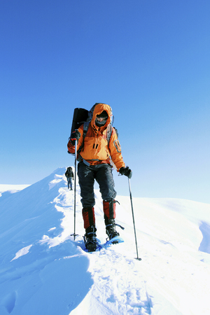
![]()
3. Top GPS Navigation Devices for 2025 Thru-Hikes
When youre tackling legendary American trails like the Pacific Crest Trail, Appalachian Trail, or Continental Divide Trail, having a reliable GPS device is a game-changer. Here’s a handpicked list of the best GPS navigation devices for 2025 thru-hikes, featuring top brands and models that are favorites among U.S. hikers. Whether you’re looking for advanced mapping features, solid battery life, or satellite communication, there’s something here for every long-distance trekker.
Best GPS Devices at a Glance
| Device | Main Features | Battery Life | Why Hikers Love It |
|---|---|---|---|
| Garmin GPSMAP 67i | Satellite messaging, topo maps, robust build | Up to 165 hrs (standard mode) | Reliable tracking & SOS anywhere on trail |
| Garmin inReach Mini 2 | Compact, two-way texting, SOS function | Up to 14 days (default mode) | Pocket-sized & perfect for ultralight hiking |
| Garmin eTrex SE | User-friendly interface, Bluetooth connectivity | Up to 168 hrs (standard) | Affordable option with essential navigation tools |
| Sigma Rox 12.0 Sport | Full-color touchscreen, WiFi sync, cycling/hiking modes | Up to 16 hrs | Great for multi-sport adventurers on the go |
| Suzuki Satmap Active20 US Edition | Large display, waterproof, preloaded US topo maps | Up to 16 hrs (replaceable batteries) | Tough design stands up to wild weather |
| Avenza Maps App + Smartphone* | Offline topo maps, easy map import/export | Phone-dependent (bring power bank!) | Budget-friendly & familiar interface for tech-savvy hikers |
| MagiCure Pathfinder Pro X1+ | Dual-frequency GNSS, touch display, solar charging support | Up to 40 hrs (with solar assist) | Cuts through dense forests with pinpoint accuracy |
| Bryton Rider S800E (Hiking Mode) | High-res screen, customizable tracking screens | Up to 36 hrs (GPS mode) | Sleek and lightweight for speed-focused hikers |
| Bushnell BackTrack Mini GPS | No-fuss breadcrumb navigation, compact size | Up to 16 hrs (continuous use) | Simplicity at its best—easy for beginners! |
| Zoleo Satellite Communicator* | Email/text via satellite link when phone out of range; rugged design | 200+ hours standby; up to several days use per charge | Keeps you connected off the grid with minimal fuss |
*Note:
The Avenza Maps app and Zoleo Satellite Communicator both require your smartphone. Always pack a backup charger or solar panel when using phone-dependent navigation tools.
The Features American Thru-Hikers Want Most:
- SOS Functionality: Fast emergency help wherever you roam.
- Long Battery Life: Stay powered up between resupply stops.
- User-Friendly Interface: Quick access to maps and waypoints—even with gloves on.
- Tough Build: Withstands rain, mud, dust, and accidental drops.
- Slim Profile: Every ounce counts on big-mile days!
Navigating Iconic Trails Made Easy
No matter which trail you choose—PCT, AT, CDT or others—these GPS devices can keep you safe and oriented from start to finish. The right device gives peace of mind so you can focus on the miles ahead and the beauty around every bend.
4. Comparing Devices: Pros, Cons, and Best Use Scenarios
Choosing the right GPS navigation device for thru-hiking iconic American trails like the Appalachian Trail or Pacific Crest Trail can make a big difference in your experience. Here’s a side-by-side comparison of the top 10 GPS devices, focusing on their features, real-life performance, and what kinds of hikers or trail regions each one is best for.
Device Comparison Table
| Device | Key Features | Pros | Cons | Best For |
|---|---|---|---|---|
| Garmin GPSMAP 66i | Satellite messaging, topo maps, SOS, robust battery | Reliable signal, detailed maps, emergency functions | Bulky, higher price | Solo hikers in remote areas |
| Garmin inReach Mini 2 | Compact, satellite texting, SOS | Tiny size, lightweight, good battery life | Tiny screen, limited mapping | Ultralight solo trekkers or group leaders as backup device |
| Suunto Vertical | Barometer, altimeter, route planning app sync | Sleek watch design, accurate tracking | No messaging/SOS feature | PCT/JMT hikers wanting wrist-based navigation |
| Garmin eTrex 32x | User-friendly joystick controls, topo mapping | Long battery life, durable build | No satellite comms or SOS function | Budget hikers on established trails (AT) |
| Avenza Maps App (Smartphone) | Offline maps, GPS tracking via phone GPS chip | No extra device needed, lots of map choices | Dependent on phone battery/longevity | Section hikers or tech-savvy groups with power banks |
| Garmin Montana 700i | Large touchscreen, satellite comms & SOS, preloaded topo maps | User-friendly interface, strong antenna signal | Larger size/weight than most handhelds | Small groups planning off-trail adventures in the Rockies or Sierras |
| Bryton Rider S800E (Bike/Hike) | Cycling & hiking modes, color touchscreen | Doubles for multi-sport trips | No satellite communication features | Bikers/hikers doing mixed adventure routes |
| COTRE D2 GPS Tracker | SOS button, basic location sharing | Straightforward operation; affordable | No map display; minimal features | Younger hikers or families needing simple safety tracking |
| Zoleo Satellite Communicator | Messaging via phone app over Iridium network | Works anywhere; flexible messaging plans | No standalone screen; needs phone for navigation | Buddies hiking together who want cheap but reliable check-ins |
| Bushnell BackTrack Mini GPS | Barebones waypoints and tracking only | Tiny size; easy to use; super affordable | No maps or comms; limited data storage | PCT weekenders or casual hikers staying near trailheads |
Insights by Scenario and Trail Region
For Solo Thru-Hikers:
- The Garmin GPSMAP 66i, with its built-in SOS and two-way messaging capabilities, is a top pick for those tackling isolated sections where help may be far away.
- The inReach Mini 2, while small and light for ultralighters, serves best as an emergency lifeline rather than primary navigation due to its tiny screen.
For Groups or Families:
- The Zoleo Satellite Communicator’s group chat function and affordable messaging plans make it great for teams wanting to stay connected without shelling out for multiple full-featured devices.
- The COTRE D2 GPS Tracker’s simplicity lets parents track kids or new backpackers easily.
By Trail Region:
- PCT & CDT: Devices with long battery life and reliable topo mapping (eTrex 32x/Montana 700i/Suunto Vertical) shine where cell service is non-existent and terrain is challenging.
- Easier Trails (AT/section hikes):The Avenza Maps App or Bushnell BackTrack Mini GPS provide budget-friendly solutions when resupply points are frequent and emergencies less likely.
User Tip:
If you’re hiking in a group but splitting up occasionally—like on side trips to town—the leader should carry a full-featured unit (GPSMAP 66i or Montana 700i), while others can use simpler trackers or smartphone apps to save weight.
5. Tips for Maximizing GPS Use on American Trails
Optimize Your GPS Setup Before Hitting the Trail
Before you start your thru-hike, take some time to familiarize yourself with your GPS device. Download detailed maps of the specific American trail you’ll be hiking—like the Pacific Crest Trail, Appalachian Trail, or Continental Divide Trail. Make sure your route is pre-loaded and waypoints are marked for resupply points, water sources, and campsites. Update your firmware and check for recent map updates to avoid surprises out there.
Battery Conservation Strategies in the Backcountry
Batteries drain fast on long hikes, especially in remote areas where charging options are limited. Here’s a quick guide to help you stretch your GPS battery life:
| Tip | Description |
|---|---|
| Lower Screen Brightness | Dim your screen to save power when reading maps. |
| Turn Off Unused Features | Disable Bluetooth, Wi-Fi, and unnecessary sensors. |
| Use Battery Saver Mode | Select this mode to limit background activity. |
| Carry Extra Batteries/Power Banks | Packing spares ensures you’re not left stranded. |
| Turn Off When Not Navigating | Only power on the device when you need to check location or routes. |
Navigating Off-Trail: Stay Safe and Smart
If you lose the path or need to detour around obstacles like fallen trees or washed-out bridges, use your GPS’s waypoint marking feature. Drop a pin at your current location before heading off-trail so you can easily backtrack. Set alerts for proximity to the official route to help steer you back if you wander too far. Always keep your device dry and protected—American trails can throw unexpected weather at you!
Integrate GPS with Traditional Map-and-Compass Skills
No matter how advanced your GPS unit is, it’s smart to carry a paper map and a reliable compass as backup. Practice cross-referencing your digital position with your physical map regularly—it helps build confidence and ensures you know where you are even if batteries die or technology fails. Many seasoned hikers in the U.S. recommend reviewing both tools every evening at camp or during breaks. This combo approach is especially helpful in dense forests or deep canyons where satellite signals might drop out.
Quick Checklist: Ultimate Backcountry Confidence
- Pre-load maps & update firmware before departure
- Pack extra batteries/power banks for longer trips
- Mark key waypoints (water, camp, exits)
- Regularly practice map-and-compass navigation alongside GPS use
- Protect devices from moisture and impacts with sturdy cases or dry bags
- Set up emergency contacts and share your planned route with someone back home
The right mix of tech know-how and classic navigation will keep you safe and confident while trekking America’s legendary long-distance trails!