1. Defining Trail Ratings: Benefits and Limitations
When planning a hike in the United States, most outdoor enthusiasts turn to trail ratings as their go-to guide for understanding what to expect. These ratings, often seen on websites, maps, or trailhead signs, are designed to quickly communicate how difficult a particular trail is supposed to be. But while these systems offer a helpful starting point, they don’t always capture the full picture of what you’ll actually experience once you hit the trail.
How Trail Ratings Work
Trail rating systems in the U.S. are usually meant to standardize trail difficulty so that hikers can make informed decisions. Common categories include:
| Rating | Description |
|---|---|
| Easy | Gentle slopes, well-marked paths, minimal obstacles—good for beginners and families. |
| Moderate | Some steeper sections, uneven ground, occasional obstacles—suitable for hikers with some experience. |
| Difficult/Strenuous | Steep grades, rocky terrain, longer distances—recommended for experienced hikers only. |
The idea is simple: give everyone a general sense of what they’re getting into before setting out.
The Benefits of Standardized Ratings
- Safety: Helps hikers choose trails suited to their abilities.
- Accessibility: Makes it easier for visitors from different regions or backgrounds to compare trails.
- Simplicity: Saves time by offering an at-a-glance overview instead of reading through lengthy descriptions.
The Limitations: Where Trail Ratings Fall Short
Despite their usefulness, trail ratings can be surprisingly limited when it comes to reflecting real-world conditions. Here’s why:
- Local Variability: What’s considered “easy” in one region (like a flat walk in the Midwest) might feel much tougher in another area (such as a rocky path in the Rockies).
- Seasonal Changes: Trails rated as easy in summer could become slippery and hazardous after rain or during winter snow.
- Lack of Detail: Ratings rarely mention things like exposure to sun, water crossings, or wildlife considerations that could dramatically impact your experience.
- Subjective Impressions: Trail conditions change over time, and what one ranger calls “moderate” might seem challenging to someone else based on personal fitness or hiking background.
Example: The Same Rating, Different Experience
| Trail Name | Region | Rating | User Experience |
|---|---|---|---|
| Pine Loop Trail | Nebraska | Easy | Smooth, shaded path; little elevation gain; quick family outing. |
| Pine Loop Trail | Colorado Rockies | Easy | Narrow trail; rocky sections; high altitude makes breathing harder even though distance is short. |
This table shows how two trails with the same name and rating can feel completely different depending on where you are. That’s why local knowledge is key—something we’ll explore further in upcoming sections.
2. Local Knowledge: The Ultimate Insider Advantage
When you’re planning a hike in the U.S., trail ratings and maps are a great place to start—but they don’t always tell the whole story. That’s where local knowledge steps in. Insights from local hikers, park rangers, and outdoor communities can be your secret weapon for a safe and memorable adventure.
Why Local Knowledge Matters
Trail ratings might say “moderate” or “difficult,” but what does that really mean? Maybe a trail is labeled as easy, but recent storms have washed out sections. Or perhaps there’s a shortcut that only locals know about. Local experts see the trails every day—they notice changes, spot hazards early, and understand how conditions shift with the seasons.
What Locals Know (That Ratings Don’t)
| Local Insight | How It Helps You |
|---|---|
| Recent Weather Impacts | Alerts you to muddy spots, flooded streams, or fallen trees |
| Wildlife Activity | Keeps you aware of recent bear or snake sightings |
| Hidden Gems | Leads you to quiet viewpoints or off-the-beaten-path waterfalls |
| Trail Etiquette & Rules | Makes sure you’re up-to-date on local regulations and customs |
| Seasonal Changes | Tells you when wildflowers bloom or when bugs get bad |
Where to Find Local Info
The best sources for these details aren’t always official websites. Try chatting with:
- Park Rangers: They know about current trail conditions and any closures.
- Visitor Centers: Staff can offer tips on less-crowded routes and up-to-date maps.
- Local Hikers: Join online forums like Reddit’s r/hiking, regional Facebook groups, or check AllTrails comments for real-time updates.
- Outdoor Shops: Employees often hike nearby trails themselves and love sharing advice.
- Campsites: Fellow campers are usually happy to swap stories and tips over morning coffee.
The Takeaway on Trail Ratings vs. Local Tips
If you want the full scoop on a trail, combine what you read online with what you hear from those who know the area best. A quick chat with someone local could make your hike safer, more enjoyable, and even lead you to discover something unforgettable off the main path.
![]()
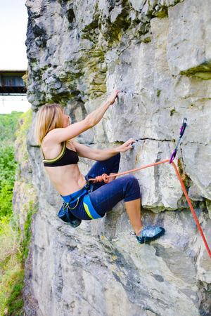
3. Hidden Hazards and Seasonal Surprises
Even if a trail is rated as “moderate” or “easy,” there can be surprises along the way that only locals know about. Trail ratings rarely capture the full picture—especially when it comes to the unexpected challenges you might face out in the wild.
Weather: More Than Just Rain or Shine
In many parts of the U.S., weather can change fast and without warning. Locals know which trails turn muddy after a quick thunderstorm, which ridges get icy before the first snowfall, and which valleys are prone to sudden fog. For example, in the Rockies, afternoon storms roll in quickly during summer—something not always reflected in a trail’s official rating.
| Region | Seasonal Weather Surprise | Local Tip |
|---|---|---|
| Pacific Northwest | Mudslides in spring | Check with rangers after heavy rain |
| Appalachians | Slick leaves in fall | Wear shoes with extra grip |
| Southwest Deserts | Flash floods in summer | Avoid slot canyons during monsoon season |
| Rockies | Afternoon lightning storms in summer | Plan hikes early and leave exposed peaks by noon |
Wildlife Activity: Not Always on the Map
You might not find notes about wildlife hotspots on your favorite hiking app, but locals will tell you when and where to expect animals. In Yellowstone, for example, bison migrate across certain trails at specific times of year. Bears become more active during berry season in the Sierras. Snakes may be sunning themselves on Southern California trails during warm afternoons.
Common Wildlife Surprises and Local Advice:
- Bears: Carry bear spray and make noise in dense forests (Montana, Wyoming)
- Bison: Give them plenty of space; they’re faster than they look (Yellowstone)
- Snakes: Watch for rattlesnakes on rocky paths (Arizona, Texas)
- Ticks: Wear long sleeves and check yourself after hikes (Midwest, Northeast)
Trail Maintenance Issues: The Unseen Obstacles
A trail may look clear on your map, but recent storms, fallen trees, or washed-out bridges can block your route. Trail conditions are often best known by those who walk them regularly—local hikers or park staff. Sometimes reroutes aren’t marked online yet, and only someone familiar with the area can point you to a safe detour.
How to Get Insider Info:
- Chat with local hikers at the trailhead or visitor center.
- Follow regional hiking groups on social media for up-to-date trail reports.
- Check bulletin boards at trailheads for handwritten notes from rangers or other hikers.
- If available, call local ranger stations before heading out.
The bottom line? While trail ratings are helpful starting points, nothing beats learning from those who know the land best. Local knowledge helps you prepare for hazards you won’t read about online—and keeps your adventure safe and enjoyable.
4. Regional Trail Culture and Etiquette
When you hit the trail in the United States, you’ll quickly find that every region has its own unique hiking culture. These unwritten rules can affect everything from who steps aside on a narrow path to how campers set up their tents for the night. Knowing these local customs not only helps you fit in—it also keeps your adventures safe and enjoyable.
Unspoken Rules: More Than Just Trail Ratings
Trail ratings (like “easy” or “difficult”) tell you a lot about terrain and elevation, but they rarely capture the social side of hiking. For example, right of way—who yields to whom—can be different in the Pacific Northwest compared to the Appalachian Mountains. In some areas, hikers always step aside for those coming uphill; in others, mountain bikers or horseback riders may have priority.
Common Regional Variations
| Region | Right of Way | Camping Norms | Stewardship Traditions |
|---|---|---|---|
| Pacific Northwest | Uphill hikers have right of way; yield to equestrians | Dispersed camping common; pack out all trash | Leave No Trace is strictly followed; frequent volunteer days |
| Southwest | Bikers often have special trails; respect for indigenous lands emphasized | Campsites often far apart; avoid disturbing desert crust | Water conservation is key; don’t build new fire rings |
| Northeast (Appalachians) | Narrow trails mean frequent yielding; hikers greet each other more often | Shelter etiquette important; register at trailheads when possible | Trail maintenance is community-driven; help clear debris if safe to do so |
| Rocky Mountains | Yield to horses; step well off trail when passing wildlife watchers | Avoid camping near water sources; respect quiet hours strictly enforced by rangers | Packing out all waste expected, including TP and food scraps |
The Best Teachers: Local Hikers and Rangers
If you’re ever unsure about what’s expected on a particular trail, don’t hesitate to chat with local hikers, rangers, or outdoor shop staff. They’ll happily fill you in on what’s considered good manners in their area—whether it’s where to park your car, how to greet other hikers, or which areas are especially sensitive to foot traffic.
Quick Tips for Learning Local Etiquette:
- Observe: Watch how locals behave at trailheads and along the route.
- Ask: A simple “Hey, what’s the usual here?” goes a long way.
- Read signs: Many parks post rules specific to the region.
- Respect traditions: Even if they seem quirky, following them shows respect for the community and environment.
No matter where your next hike takes you, being aware of regional trail culture helps you blend in and enjoy a safer, friendlier outdoor experience—sometimes even more than knowing the official trail rating does!
5. Resources for Tapping into Local Insight
When you’re planning a hike, online trail ratings and guidebooks are helpful—but nothing beats local knowledge for getting the real scoop. Here’s where you can find reliable, on-the-ground info in the U.S., whether you’re exploring the Rockies, Appalachians, or your own backyard trails.
Trailhead Bulletin Boards
Most popular U.S. trailheads feature bulletin boards packed with recent updates from park staff and other hikers. Look for notes about washed-out bridges, wildlife sightings, or muddy sections that might not show up online. Always take a minute to read these before heading out—they can save you a lot of trouble.
Ranger Stations and Visitor Centers
Chatting with a ranger is one of the best ways to get the lowdown on current trail conditions. Rangers live and breathe these places; they know which trails are overgrown, which have tricky creek crossings, and what weather to watch for. Don’t be shy—ask questions like:
- Are there any recent closures or hazards?
- What do you recommend for my experience level?
- Any local tips I should know?
Local Hiking Groups and Clubs
America has a vibrant hiking community. Many towns have clubs that organize group hikes and share trail tips. Joining one—even just following their Facebook page—can connect you to people who hike your chosen area every week. Some well-known national organizations include the Sierra Club, Appalachian Mountain Club, and The Mountaineers.
Online Forums and Social Media
The internet is full of U.S.-based hiking forums and social media groups where locals share firsthand reports. Popular options include:
| Resource | Description |
|---|---|
| Reddit r/hiking | National forum for all things hiking; search for regional subreddits too. |
| AllTrails Community Reviews | User-submitted trail reviews with up-to-date conditions and photos. |
| Facebook Hiking Groups | Search for state or city-specific groups (e.g., “Hiking Colorado”). |
| Backpacker Forums | Discussions by region, gear advice, trip reports, and more. |
Pro Tip: Ask Specific Questions
If you post in an online forum, be specific! Instead of “Is Trail X good?”, try “Has anyone hiked Trail X this week? How’s the river crossing after last night’s rain?” You’ll get better responses from folks who’ve actually been there recently.
Quick Reference: Where to Find Local Trail Intel
| Resource Type | Best For |
|---|---|
| Trailhead Bulletin Boards | Last-minute updates right at the start point |
| Ranger Stations/Visitor Centers | In-depth, expert local advice & safety info |
| Local Clubs/Groups | Crowdsourced insights & meet-up opportunities |
| Online Forums/Social Media | The latest reports & photos from real hikers |
Tapping into these local resources helps fill in the gaps that official ratings can miss. With a little extra effort, you’ll have a much clearer picture of what’s really waiting out on the trail—and how to prepare for it!
6. Making Informed Decisions on the Trail
When planning a hike or backpacking trip in the United States, many people rely on official trail ratings as their main source of information. These ratings—like “easy,” “moderate,” or “difficult”—give a basic idea of what to expect, but they don’t always tell the full story. Local knowledge from experienced hikers, rangers, and community groups can fill in the gaps and help you make smarter choices. Here’s how you can blend both sources for a safer, more enjoyable adventure.
Why Local Intel Matters
Trail conditions change all the time due to weather, maintenance schedules, and natural events like landslides or wildfires. Locals often know about these changes long before they’re updated on official websites or maps. They can also point out seasonal hazards (like icy creek crossings in spring), unofficial side trails with great views, or wildlife hotspots you’d otherwise miss.
Combining Ratings and Local Advice: A Simple Guide
| Official Trail Ratings | Local Knowledge | How to Use Both |
|---|---|---|
| General trail difficulty | Recent obstacles (fallen trees, washed-out bridges) | Adjust your expectations—what’s labeled “easy” may be tougher this week |
| Mileage and elevation gain | Current trailhead access or parking info | Avoid surprises by checking for road closures or crowded lots |
| Average hiking times | Best times of day or year to go | Plan around heat, crowds, or snowmelt for a smoother experience |
| Main route descriptions | Hidden gems nearby (waterfalls, overlooks) | Add local highlights to your plan for more rewarding adventures |
Where to Find Reliable Local Info
- Ranger stations: Call ahead or stop in for real-time updates on conditions and wildlife activity.
- Online forums and social media: Sites like AllTrails, Reddit’s hiking communities, and local Facebook groups are packed with recent trip reports.
- Outdoor retailers: Staff at local gear shops often hike nearby trails themselves and love sharing tips.
- Campsite hosts and fellow hikers: Don’t be shy about asking for advice—most outdoor folks are happy to help.
Best Practices for Planning Your Hike
- Start with official trail ratings to narrow down your options based on fitness level and desired challenge.
- Check recent trip reports and ask locals about current conditions, closures, or hazards.
- Tweak your plans if needed—be flexible if locals warn you about unexpected challenges.
- Pencil in extra time for exploring side attractions that only locals know about.
- Always let someone know your itinerary, especially if you’re heading into remote areas.
The Bottom Line: Blend Both Worlds for Better Adventures
The best trail experiences come from mixing official info with boots-on-the-ground advice. By using both resources together, you’ll not only stay safer but also discover unique spots and stories that make every hike memorable.