1. Understanding Seasonal Hazards Across the US
The United States is a land of striking natural diversity, and each region comes with its own set of seasonal hazards. Whether you’re exploring snow-capped mountains, sun-baked deserts, or lush forests, being aware of these risks is key to safe travel and adventure. Let’s look at what you might encounter in different parts of the country.
Common Seasonal Dangers by Region
| Region | Main Hazards | Typical Season |
|---|---|---|
| Northern States (e.g., Minnesota, Montana) | Heavy snow, ice storms, blizzards | Winter (Dec – Mar) |
| Southwest (e.g., Arizona, Nevada) | Extreme heat, drought, flash floods | Summer (May – Sep) |
| Mountainous Areas (e.g., Colorado Rockies) | Avalanches, sudden weather changes, altitude sickness | Year-round (peaks in winter/spring) |
| Southeast (e.g., Florida, Louisiana) | Hurricanes, heavy rain, flooding | Late Summer to Fall (Jun – Nov) |
| Northeast (e.g., New York, Vermont) | Icy roads, snowstorms, cold snaps | Winter (Dec – Mar) |
| West Coast (e.g., California) | Wildfires, mudslides, earthquakes* | Late Summer/Fall for fires; rainy season for slides |
*Note: Earthquakes are not seasonal but can impact terrain navigation year-round.
Why Knowing Local Hazards Matters
If you’re road-tripping through snowy states or hiking desert trails, understanding what weather and terrain challenges to expect helps you plan smarter. For example:
- Icy Winters: In northern regions, roads can become slick quickly. Map apps may show closures or detours during storms.
- Desert Heat: In the Southwest, hydration and knowing emergency stops are crucial. Some routes may be closed due to extreme temperatures or flash flooding.
- Mountain Conditions: Elevation changes bring thinner air and unpredictable weather—always check local advisories before heading out.
Using US Maps for Safer Navigation
Tapping into reliable map apps or printed maps updated with current conditions can make all the difference when navigating special terrains. Many mapping tools highlight real-time hazards like road closures from snow or detours around wildfire zones. Get in the habit of checking your route before you go and packing accordingly for the season’s demands—your safety starts with knowledge!
2. Preparing for Snow and Ice in Northern States
Essential Tips for Navigating Snowy Roads
Winter in the northern United States brings unique challenges for drivers, hikers, and travelers. Heavy snowfall and icy conditions can quickly turn a regular route into a hazardous journey. Here are some practical tips to keep you safe when navigating these wintry roads:
- Check Your Vehicle: Make sure your tires have enough tread, your windshield wipers work well, and your car battery is strong.
- Slow Down: Snow and ice make stopping distances much longer. Drive slower than usual, even if roads look clear.
- Keep Essentials Handy: Always carry an emergency kit with blankets, water, snacks, a flashlight, and a phone charger in your car.
- Avoid Cruise Control: On slippery roads, cruise control can be dangerous because it may prevent you from reacting quickly.
- Know When to Stay Home: If weather advisories say travel is risky, postpone your trip if possible.
Reading Winter Weather Advisories on US Maps
Before heading out, its important to check winter weather advisories. US maps often use color codes and symbols to show areas with snowstorms, icy roads, or road closures. Here’s how you can easily interpret them:
| Map Color/Symbol | Meaning | What To Do |
|---|---|---|
| Light Blue | Snowfall Area | Expect reduced visibility and slippery roads; drive with caution. |
| Red Triangle (!) | Hazard Warning/Icy Roads | Avoid travel if possible; seek alternate routes or delay your trip. |
| Yellow Line | Caution: Slow Traffic/Delays | Allow extra time; keep extra distance between vehicles. |
| White Shading | Heavy Snowstorm Predicted | Prepare for potential closures; keep emergency supplies ready. |
Where to Find Reliable Map Updates
- National Weather Service (NWS): Offers up-to-date winter storm warnings and road condition alerts across the US.
- 511 Road Conditions Map: Provides real-time traffic updates and road closures by state.
- Google Maps & Apple Maps: Show real-time traffic slowdowns and detours due to weather.
The Best Routes for Avoiding Hazardous Conditions
If you need to travel through snowy states like Minnesota, Michigan, or upstate New York, planning your route ahead of time is key. Main highways are usually plowed first and receive more attention from road crews. Whenever possible, stick to major interstates rather than rural backroads. Here’s a quick comparison:
| Main Highways (Interstates) | Backroads/Secondary Roads | |
|---|---|---|
| Pavement Clearing Priority | High (frequently plowed & salted) | Low (may remain snowy/icy longer) |
| Shelter Access (Gas Stations/Motels) | Easier access along route | Limited services available |
| Road Condition Updates Available? | Yes—regularly updated online & on radio | No/limited updates available |
| Sightseeing Opportunity vs. Safety | Safer but less scenic during storms | More scenic but riskier in winter weather |
Packing Tips for Winter Travel in Northern States
- Pack extra layers of clothing, gloves, hats, and boots for everyone traveling with you—including kids!
- If you’re driving alone, let someone know your planned route and estimated arrival time.
- Tuck a small shovel and cat litter or sand in your trunk in case you get stuck on ice.
By understanding how to read winter weather maps and choosing safer routes ahead of time, you’ll help ensure every snowy adventure stays as safe as it is beautiful!
3. Surviving the Desert Heat and Arid Terrain
Smart Strategies for Desert Travel
Traveling across America’s deserts, like those found in Arizona, Nevada, and parts of California, requires special planning. The desert is beautiful but challenging, with extreme temperatures and little water. Here are some friendly tips to help you stay safe:
- Plan Your Route: Always check your route on a reliable US map before heading out. Look for paved roads, rest stops, and emergency services.
- Travel Early or Late: To avoid the hottest part of the day, travel in the early morning or late afternoon whenever possible.
- Stay Hydrated: Bring more water than you think you’ll need. The dry air can make dehydration sneak up quickly.
- Watch for Wildlife: Be alert for animals crossing the road, especially at dawn or dusk.
What to Watch For on Desert Maps
When looking at maps designed for desert regions, pay attention to these features:
| Map Feature | Why It’s Important |
|---|---|
| Water Sources | Identifies places to refill bottles or take a break from the heat. |
| Emergency Services | Shows hospitals, ranger stations, or call boxes along your route. |
| Paved vs. Unpaved Roads | Paved roads are usually safer and easier to navigate in desert conditions. |
| Shelter Locations | Look for shaded rest areas or shelters marked on the map. |
| Distance Between Stops | Keeps you aware of how far you’ll travel before the next opportunity to restock supplies. |
How to Prepare for Dehydration and Sandstorms
- Packing Essentials: Always carry extra water (at least one gallon per person per day), snacks with electrolytes, sunblock, sunglasses, and a wide-brimmed hat.
- Dressing Right: Wear light-colored, breathable clothing that covers your skin to protect against sunburn and keep you cooler.
- If You Encounter a Sandstorm: Pull over safely if driving—don’t try to drive through low visibility. Stay inside your vehicle, close windows and vents, and wait until it passes.
- Avoid Getting Lost: GPS can lose signal in remote areas—bring a physical map as backup and mark important landmarks ahead of time.
- Telling Someone Your Plans: Let someone know your route and expected arrival times before heading into remote desert areas.
Your Well-Being Comes First!
The desert can be both stunning and unforgiving. With a little preparation and by using detailed US maps tailored for desert travel, you can focus on enjoying the adventure while keeping yourself safe and comfortable.
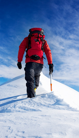
4. Navigating Mountainous Regions Safely
Smart Tips for Driving and Hiking in the Mountains
Mountain adventures are truly breathtaking, but they also come with unique challenges. Whether you’re driving scenic roads or hiking beautiful trails, being prepared is key. Here are some practical tips to keep your mountain journeys safe:
| Activity | What to Watch Out For | Helpful Tips |
|---|---|---|
| Driving | Steep grades, sharp curves, sudden weather changes | Use low gears on steep descents, check brakes before trips, carry tire chains in snowy seasons, and drive slowly around bends |
| Hiking | Rapid elevation changes, thin air, changing trail conditions | Pace yourself, bring plenty of water and snacks, dress in layers, know the symptoms of altitude sickness, and always let someone know your route |
Understanding Elevation Changes on US Maps
If you’re using USGS or state park maps, look for contour lines—these show elevation changes. The closer the lines are together, the steeper the terrain. This can help you plan safer routes and avoid unexpectedly tough climbs or descents.
Quick Guide: Reading Elevation on a Map
| Map Feature | What It Means | Why It Matters |
|---|---|---|
| Contour Lines Close Together | Very steep slope or cliff area | Might need extra caution; may not be suitable for all skill levels |
| Wide-Spaced Contour Lines | Gentle slope or flat area | Easier walking or driving; good rest spots or picnic areas |
| Marked Peaks/High Points | The highest elevations around you (often labeled with exact feet/meters) | Great viewpoints but may require strenuous effort to reach |
Staying Safe from Avalanches and Rockslides
Avalanches and rockslides are real risks in American mountain regions like the Rockies and Sierra Nevada. Always check local advisories before heading out. In winter, stick to marked avalanche-safe trails and avoid hiking or driving below steep snow-covered slopes. In spring and summer, watch for falling rocks after heavy rains or freeze-thaw cycles.
Avalanche & Rockslide Safety Checklist:
- Check avalanche forecasts at avalanche.org
- Cary an emergency kit including a whistle, flashlight, first aid supplies, and extra food/water
- Avoid stopping directly below cliffs or steep slopes when taking breaks on trails or pull-offs
- If you hear cracking sounds or see recent slides/debris on a trail or road, turn back immediately
- If hiking with others, keep some distance between group members on risky sections to reduce hazard exposure
Stay smart and prepared so your mountain experience remains both safe and memorable!
5. Choosing the Right US Map for Different Terrains
Traveling across the United States can be an incredible adventure, but every region comes with its own set of challenges—especially when you’re facing snow-covered roads, dry desert stretches, or winding mountain trails. Having the right map or navigation tool can make all the difference. Here’s a practical guide to help you pick the best options for each terrain, so you can stay safe and confident on your journey.
Understanding Your Terrain Needs
Before you hit the road or trail, think about where you’ll be traveling. Are you driving through snowy passes in Colorado, hiking in Arizona’s deserts, or taking a scenic route through the Rockies? The tools that work best for each environment vary, so matching your map to your surroundings is key.
Common US Map Types and Navigation Tools
| Terrain Type | Best Map/Tool Type | Recommended Apps & Resources | Key Features to Look For |
|---|---|---|---|
| Snowy Regions | Paved Road Maps, Weather-Integrated GPS | Google Maps, Waze, NOAA Weather App, AAA Roadside Assistance | Live weather updates, road closure alerts, alternative route suggestions, offline mode |
| Desert Areas | Topographic Maps, Offline GPS Apps | Gaia GPS, AllTrails, Avenza Maps | Offline access, detailed land features, water sources marked, heat warnings |
| Mountainous Terrain | Hiking Trail Maps, Elevation Data Tools | AllTrails, Gaia GPS, National Park Service Maps | Elevation profiles, trail difficulty ratings, emergency SOS features |
Tips for Picking the Best Map or App for Your Trip
- Check for Offline Capability: Cell service can disappear quickly in remote mountains or deserts. Make sure your chosen app lets you download maps ahead of time.
- Look for Real-Time Updates: For snowy areas especially, choose apps that provide live traffic and weather info. This helps avoid dangerous roads and keeps you updated on closures.
- Prioritize Safety Features: Some GPS tools offer emergency location sharing and direct access to rescue services—very useful if youre exploring rugged or isolated spots.
- Select Detailed Maps: Topographic maps are essential for off-road or backcountry travel because they show elevation changes and natural landmarks like rivers and cliffs.
- User Reviews Matter: Check what other travelers say about specific maps or apps for your destination. Some tools work better in certain regions than others.
Your Quick-Reference Table: Which Tool is Best?
| If You’re Going To… | Your Go-To Map/App Should Be… | Main Reason Why |
|---|---|---|
| Ski resorts or snowy highways in winter | A GPS app with weather integration (e.g., Google Maps + NOAA) | Avoid closures and icy routes safely with live updates. |
| The Southwest desert parks (like Joshua Tree) | A topographic app with offline capability (e.g., Gaia GPS) | You won’t lose your way even without cell service; see terrain details. |
| The Appalachian Trail or Rocky Mountain hikes | A hiking-specific trail app (e.g., AllTrails) | You get elevation info and user-shared tips on trails and hazards. |
A Few More Friendly Reminders:
- If you’re new to outdoor navigation tools, take a little time at home to explore your chosen app’s features before your trip.
- No matter how great technology is, always pack a printed map as backup—especially if you’ll be far from major towns or cell towers!
6. Emergency Preparedness and Local Resources
When exploring the diverse landscapes of the United States—whether you’re navigating snowy roads in Colorado, hiking through Arizona’s deserts, or driving along the winding mountain passes of California—being prepared for seasonal hazards and special terrain is essential. Here’s how to get ready for emergencies, connect with local resources, and use your US maps to find help quickly when you need it most.
How to Prepare Your Emergency Kit
Having an emergency kit tailored to your environment is a must. Here’s a quick guide to what you should pack for different terrains:
| Terrain | Essential Kit Items |
|---|---|
| Snowy Areas | Thermal blankets, hand warmers, tire chains, ice scraper, flashlight, bottled water, high-energy snacks, extra socks and gloves |
| Desert Regions | Extra water (at least 1 gallon per person per day), electrolyte drinks, wide-brimmed hat, sunscreen, lightweight clothing, emergency whistle, portable phone charger |
| Mountainous Terrain | First-aid kit, hiking boots, rain poncho, compass, map (paper backup), headlamp with batteries, protein bars |
Connecting with Local Agencies and Resources
No matter where you travel in the US, local agencies are there to help. Before your trip:
- Download local emergency apps: Many states have their own alert systems (like California’s CalAlerts or Colorado’s COtrip).
- Save non-emergency numbers: Keep county sheriff or ranger station contacts handy.
- Check weather and hazard updates: Use reliable sources like NOAA Weather Radio or state Department of Transportation websites.
- Follow social media accounts: Local police and fire departments often post real-time updates on Twitter or Facebook.
Using Map Features to Locate Help Quickly
Your US map isn’t just for directions—it can be a lifesaver in tough situations. Look out for these features while planning your route:
- Emergency Service Locations: Many digital maps highlight hospitals, urgent care centers, ranger stations, and rest stops—bookmark these before you travel.
- Mile Markers: Especially on highways and interstates, mile markers help first responders locate you faster if you call for help.
- Shelter Icons: In remote areas prone to extreme weather (like tornadoes or blizzards), some maps indicate official shelters or safe zones.
- Offline Maps: Download offline versions of Google Maps or use paper maps as a backup in case you lose cell service.
Quick Reference: What To Do in an Emergency by Terrain Type
| Situation | Action Steps Using Maps & Local Resources |
|---|---|
| Stranded in Snowstorm | Stay in your vehicle; use map to locate nearest town or shelter; alert local authorities via emergency number; turn on hazard lights; keep warm with supplies from your kit. |
| Lose Your Way in the Desert | Avoid walking during peak heat; consult map for closest road or water source; signal for help with whistle/mirror; contact local rangers if possible; ration water. |
| Caught in Mountain Storm/Fog | Shelter in place if visibility is poor; check map for nearby ranger stations or shelters; notify someone of your location if you have signal; conserve battery power on devices. |
A Little Extra Peace of Mind
No matter where your adventures take you across America’s incredible landscapes, taking these simple steps will help keep you safe—and give you confidence to handle any seasonal or terrain-related surprise along the way!