Introduction to Modern Wilderness Navigation
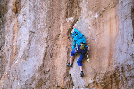
For generations, Americans have been drawn to the wild—whether trekking through the dense forests of the Pacific Northwest, hiking the rocky trails of the Appalachian Mountains, or exploring the vast deserts of the Southwest. As outdoor adventures have grown in popularity, so too has our reliance on navigation tools. The evolution from traditional compasses to advanced GPS devices has dramatically transformed how people experience the American wilderness. Today, these tools not only enhance our ability to explore but also play a crucial role in ensuring safety and survival. However, as real-life case studies show, mastering both compass and GPS skills is essential. While modern technology offers convenience and precision, understanding how to use a compass remains a fundamental skill that every outdoor enthusiast should possess. In this article, we will delve into true stories of Americans lost in the wild and reveal what these incidents teach us about the importance of navigation know-how in the great outdoors.
2. Case Study: The Appalachian Trail Confusion
The Appalachian Trail, stretching over 2,000 miles from Georgia to Maine, is one of Americas most iconic long-distance hiking paths. Each year, thousands of hikers attempt to traverse sections or the entire length of this legendary trail. However, even experienced outdoor enthusiasts can fall victim to navigational errors. In this case study, we examine a real-life scenario involving a group of hikers who lost their way due to confusion between trail markers and over-reliance on digital devices.
The Incident: Getting Off Track
During the peak hiking season in North Carolina, a group of three friends set out to hike a well-marked section of the Appalachian Trail. Equipped with smartphones loaded with GPS apps, they felt confident about navigating the route. Unfortunately, after a heavy storm knocked down several trees and obscured key trail blazes, the hikers missed a crucial turnoff. Their GPS signal became unreliable in the dense forest canopy, and they spent hours circling back to familiar landmarks without making progress.
Decision Points: What Went Wrong?
| Decision Point | Action Taken | Alternative with Compass |
|---|---|---|
| Trail Obscured by Debris | Relied solely on GPS app; ignored compass and map | Used compass bearings to confirm correct direction despite missing trail markers |
| Poor GPS Signal | Continued following malfunctioning device | Checked map and used compass for orientation based on known landmarks |
| Panic & Fatigue Set In | Backtracked repeatedly, causing confusion and exhaustion | Stopped to reestablish position using compass triangulation techniques |
Lessons Learned: The Importance of Compass Skills
This incident highlights a critical lesson for all American hikers: while GPS technology is convenient, it is not infallible—especially in remote wilderness areas like the Appalachian Trail. Knowing how to use a traditional compass and topographic map can be a lifesaver when digital tools fail. Had these hikers taken regular compass readings and cross-referenced their position with physical maps, they could have avoided unnecessary detours and distress. Practicing basic navigation skills before hitting the trail remains an essential part of safe hiking culture across the U.S.

3. Case Study: Grand Canyon GPS Mishap
The Grand Canyon is one of America’s most iconic and breathtaking natural wonders, but it also presents serious challenges to those who venture into its vast, rugged landscape. In recent years, there was a notable incident where a group of hikers became lost in the canyon after relying solely on their GPS devices for navigation. The group, visiting from out of state, trusted their handheld GPS units to guide them along what appeared to be a straightforward route. However, the steep cliffs and deep ravines of the Grand Canyon often block satellite signals, causing GPS devices to lose accuracy or even fail completely. As a result, the hikers were led off established trails and into hazardous terrain. Their overreliance on technology left them unprepared for basic navigation without electronic assistance.
This real-life mishap highlights a crucial lesson for outdoor enthusiasts: while GPS technology can be incredibly helpful, it is not foolproof—especially in challenging environments like the Grand Canyon. Relying exclusively on digital devices can create a false sense of security and lead to dangerous situations if those devices malfunction or lose signal. In this case, the hikers did not bring physical maps or compasses, nor did they have experience with traditional navigation methods. Rescue teams eventually located the group after several stressful hours, but the incident could have ended much worse.
For American adventurers exploring national parks and wilderness areas, this case study emphasizes the importance of blending modern technology with traditional skills. Knowing how to read a map and use a compass remains essential—even in an age dominated by smartphones and GPS gadgets. Always plan ahead, carry backup navigation tools, and never underestimate nature’s ability to surprise you.
4. Understanding North: Magnetic vs. True North in America
When navigating the vast and varied landscapes of the United States, understanding the difference between magnetic north and true north is critical. Many hikers and outdoor enthusiasts, including those featured in our real American case studies, have learned—sometimes the hard way—that confusing these two concepts can lead to serious disorientation, especially in remote regions.
Magnetic North vs. True North: Whats the Difference?
True north refers to the direction along the earths surface towards the geographic North Pole. Magnetic north, on the other hand, is the direction a compass needle points, which aligns with Earths magnetic field and shifts over time due to changes in Earths core. In the US, this difference—called magnetic declination—can vary widely depending on your location.
| Location | Approximate Magnetic Declination | Navigation Impact |
|---|---|---|
| Seattle, WA | +16° East | Compass points east of true north; adjust bearings accordingly. |
| Denver, CO | +9° East | Moderate adjustment needed for accurate navigation. |
| Miami, FL | -6° West | Compass points west of true north; adjust leftward. |
| Anchorage, AK | ~+17° East | Significant adjustment required; high risk if ignored. |
Navigating Different American Terrains
The impact of magnetic declination is more pronounced in certain terrains:
- Mountain Regions: In areas like the Rockies or Sierra Nevada, even a small miscalculation can lead you miles off your intended path due to steep slopes and few landmarks.
- Dense Forests: In places such as the Pacific Northwest or Appalachian trails, low visibility makes precise navigation essential—here, adjusting for declination is vital to avoid getting lost.
- Desert Landscapes: Wide-open spaces like those in Arizona or New Mexico offer few reference points; a consistent bearing is crucial to avoid walking in circles.
Lessons from Real-Life Cases
Several American rescue missions have highlighted that even experienced navigators can become lost if they fail to account for local magnetic declination. For example, a group hiking in Colorado relied solely on their compass without adjusting for the area’s +9° east declination. Their planned route led them off course by several miles before they realized their error and corrected it using a GPS device set to true north references.
Navigational Best Practices in the US Context
- Always check current local declination values before your trip (NOAA provides updated data).
- Adjust your compass or map accordingly—many compasses allow manual declination correction.
- If using GPS devices, ensure you know whether it references true north or magnetic north settings.
- Crosstest bearings with physical landmarks when possible for greater safety.
Understanding and respecting the difference between magnetic and true north is not just academic—it’s a practical skill that can mean the difference between safe return and a search-and-rescue operation. As shown by American wilderness experiences, thorough preparation and knowledge of navigation fundamentals are essential for every outdoor adventure.
5. Lessons Learned: Combining Old-School and High-Tech Tools
When we look at real-life American wilderness incidents, one truth stands out: relying solely on either a compass or GPS can be risky. Through many search-and-rescue case studies—from the dense forests of the Pacific Northwest to the vast deserts of Arizona—lost hikers often discovered that technology and tradition work best together. Let’s break down the key lessons learned and share some practical tips for blending these navigation tools in the wild.
Why Both Compass Skills and GPS Matter
GPS devices are incredibly convenient, offering pinpoint location data and route tracking with the touch of a button. However, batteries die, signals drop, and electronics can fail—especially in remote areas with thick tree cover or deep canyons. A reliable compass, on the other hand, never runs out of power and isn’t affected by terrain or weather, but it demands practice and an understanding of maps. American wilderness rescue stories repeatedly highlight situations where hikers with both skill sets could correct course quickly, while those lacking traditional navigation knowledge faced greater danger when their gadgets quit.
Key Takeaways from Real Incidents
- Backup is essential: Several cases involved lost hikers whose GPS units stopped working due to dead batteries or water damage. Those who carried a map and compass—and knew how to use them—were able to find their way back to safety.
- Practice makes perfect: In national parks like Yosemite or Shenandoah, rangers report that visitors who regularly practice using both tools are far less likely to require rescue assistance.
- Technology can mislead: Some GPS apps have outdated or incorrect trail data. Compass skills help double-check digital directions against physical landmarks, reducing reliance on potentially flawed information.
Practical Tips for Safe Navigation
- Always carry both a compass and a fully charged GPS device (or smartphone with offline maps) on your trips.
- Before heading out, spend time learning how to orient a map with your compass, take bearings, and identify major landmarks in your planned area.
- Regularly check your position on both your GPS and paper map during hikes—don’t wait until you’re lost!
- If your GPS fails, stay calm: use your compass to determine direction and retrace your route using known features from your map.
The bottom line? Blending old-school navigation skills with high-tech tools isn’t just smart—it’s vital. As countless American outdoor adventurers have learned firsthand, being prepared means knowing how to use every resource available for safe exploration and quick recovery if things go off track.
6. Wilderness Wisdom: Preparing for Your Next American Adventure
Essential Advice for US Outdoor Enthusiasts
Venturing into the vast and varied wilderness of America requires more than just a love for nature—it calls for skill, preparation, and a deep respect for the environment. Whether you’re hiking in the Rockies, camping in Yosemite, or backpacking through the Appalachian Trail, being prepared can mean the difference between a memorable adventure and a dangerous ordeal.
Invest in Training and Practice Navigation Skills
Before heading out, invest time in learning how to use both a compass and a GPS device. Join local navigation workshops or seek out online courses tailored for US terrains. Practice reading topographic maps and matching them with real-world landmarks during day hikes. Remember, technology is helpful but not infallible—always carry backup navigation tools and know how to use them.
Pack Smart and Plan Ahead
Your gear should reflect both your destination and duration. Always pack essentials: a reliable map, compass, charged GPS unit (with extra batteries), water, food, first-aid kit, headlamp, and weather-appropriate clothing. Share your trip plans with someone you trust, including your intended route and expected return time—a common practice recommended by American search-and-rescue teams.
Embrace Responsible Outdoor Ethics
Practice Leave No Trace principles to protect America’s wild spaces. Stay on marked trails whenever possible to avoid getting lost and minimize environmental impact. Be mindful of wildlife encounters—know which species inhabit the area and learn appropriate safety protocols.
Stay Calm, Stay Found
If you find yourself disoriented, stop and assess your situation calmly. Use your compass and map to re-orient yourself before moving. If lost, stay put if possible—rescuers often advise that it’s easier to locate a stationary person than someone moving unpredictably.
Continuous Learning Is Key
The best adventurers are lifelong learners. Read real-life case studies from across America to understand what went wrong—and what was done right—in past incidents. Keep your skills sharp by joining hiking groups or outdoor clubs that prioritize safety and education.
With knowledge, preparation, and respect for the land, every American wilderness adventure can be safe, enriching, and unforgettable.