1. Overview of Group Hiking Communication Needs
When planning a group hike in the U.S., having clear and reliable communication is essential for safety, coordination, and making the trip more enjoyable. The United States offers an incredible variety of hiking terrains—ranging from the dense forests of the Pacific Northwest to the rocky deserts of the Southwest and the vast mountain ranges like the Rockies and Appalachians. Each environment presents its own set of challenges that can make staying in touch with your group both important and sometimes tricky.
Why Communication Matters on Group Hikes
Whether you’re trekking a well-marked national park trail or exploring remote backcountry routes, good communication helps in many ways:
- Safety: Quick updates about hazards, injuries, or lost hikers keep everyone safer.
- Coordination: Staying organized about pace, rest stops, or changes in route keeps the group together.
- Enjoyment: Sharing discoveries, fun moments, or even trail snacks boosts morale and group spirit.
Main Challenges for Group Communication
| Challenge | Description |
|---|---|
| No Cell Signal | Many beautiful U.S. trails are far from cell towers, making phones unreliable. |
| Diverse Terrain | Mountains, forests, and canyons can block signals or separate hikers. |
| Group Size & Spread | Larger groups or those spread out over distance may have trouble hearing each other or staying in visual contact. |
| Weather Conditions | Fog, storms, or heavy rain can affect both verbal communication and device performance. |
Key Communication Needs for Hikers in the U.S.
- Reliability: Tools must work even when cell service doesn’t.
- Simplicity: Easy-to-use gear is best so everyone can stay connected without hassle.
- Durability: Devices should handle outdoor conditions like water, dust, and bumps.
- Cultural Fit: Using familiar devices and common language makes coordination smoother within diverse hiking groups across the U.S.
The Big Picture
The right communication tools help prevent mishaps and let everyone focus on enjoying America’s stunning trails together. In upcoming sections, we’ll look at popular tools and tech used by U.S. hikers to meet these needs across different landscapes—from walkie-talkies to satellite messengers and handy smartphone apps.
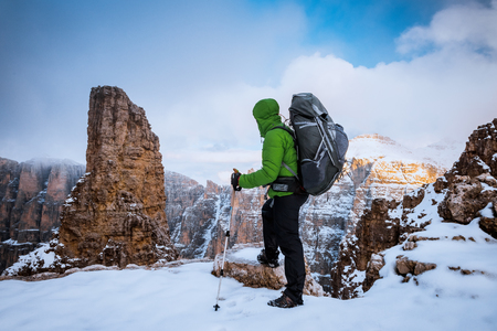
2. Popular Two-Way Radios and Walkie-Talkies
When it comes to group hikes in the U.S., two-way radios and walkie-talkies are some of the most reliable communication tools you can bring along. While cell phones are great, they often lose signal in remote or mountainous areas. That’s where handheld radios really shine, keeping your group connected whether you’re navigating a national park or exploring backcountry trails.
FRS vs. GMRS Radios: What’s the Difference?
Two of the most popular types of handheld radios for hikers are FRS (Family Radio Service) and GMRS (General Mobile Radio Service) radios. Both use similar frequencies but have some key differences that impact their range, power, and legal use in the U.S.
| Radio Type | Range (Typical) | Power Output | License Required? | Best For |
|---|---|---|---|---|
| FRS | 0.5 – 2 miles (terrain dependent) | Up to 2 watts | No | Casual hiking, family trips |
| GMRS | 1 – 5 miles (terrain dependent) | Up to 5 watts (handheld) | Yes (FCC license) | Larger groups, rugged terrain |
Range & Reliability in U.S. Backcountry
The actual range of FRS and GMRS radios depends heavily on your surroundings. Dense forests, mountains, and valleys can all limit how far your signal travels. In open areas, you might reach up to several miles, but in thick woods or hilly regions, expect much less—often less than a mile for FRS units.
Popular Models Among American Hikers
- Midland GXT1000VP4: A top choice for its durability and weather alerts; supports both FRS/GMRS channels.
- Motorola Talkabout T600: Waterproof and floats, making it ideal for wet environments or river crossings.
- Baofeng UV-5R: Popular with more advanced users for its versatility, but requires a GMRS license and programming knowledge.
Legal Considerations for U.S. Hikers
If you stick to FRS channels at low power, you won’t need a license—making these radios very user-friendly for most people. However, if you want more power or longer range with GMRS channels, the FCC requires a simple online application and a fee for a ten-year license (no exam needed). Using higher power without a license can lead to fines, so always check your radio settings before heading out.
Quick Tips for Safe Group Communication
- Select a channel before hitting the trail and make sure everyone knows how to use their radio.
- Keep spare batteries or portable chargers handy—especially on longer trips.
- If possible, test your radios in advance to see how they perform in different terrains.
- Avoid using emergency frequencies unless there’s a real emergency.
Using the right two-way radios keeps your group safe and connected during any hiking adventure in America’s wild places. Whether you’re planning a day hike or an overnight trek, knowing your options helps ensure smooth communication every step of the way.
![]()
3. Satellite Messengers and Personal Locator Beacons
When hiking in the U.S., especially in remote areas with no cell coverage, having reliable communication tools is essential for safety. That’s where satellite messengers and personal locator beacons (PLBs) come into play. These devices use satellites to send messages or distress signals, helping you stay connected and get help when you need it most.
How Do Satellite Messengers Work?
Satellite messengers like Garmin inReach and SPOT connect to global satellite networks. They let you send text messages, share your GPS location, or trigger an SOS alert. These tools are a game-changer for group hikes in the backcountry where regular cell phones just won’t cut it.
Main Features of Popular Devices
| Device | Messaging | SOS/Emergency | GPS Tracking | Other Key Features |
|---|---|---|---|---|
| Garmin inReach Mini/Explorer+ | Two-way texting via satellite | 24/7 SOS with rescue coordination | Real-time tracking & route sharing | Weather updates, smartphone app sync |
| SPOT Gen4/X | One-way custom and pre-set messages | SOS button for emergency response | Tracking intervals (5–60 min) | Check-in feature, compact design |
| ACR ResQLink PLB | No messaging function | Sends location & distress signal to search & rescue services | Sends precise GPS coordinates when activated | No subscription required, simple operation |
When Should You Carry These Devices?
- If your group is venturing far from established trails or into national parks with spotty service.
- If any members have medical conditions that could require quick rescue.
- If you want peace of mind for yourself and your loved ones back home.
Rescue Protocols and Using SOS Features
If something goes wrong, pressing the SOS button on a satellite messenger or PLB sends your exact GPS location to a 24/7 emergency response center. In the U.S., organizations like GEOS coordinate with local search and rescue teams to get help fast. This can be a lifesaver when minutes matter and cell phones can’t reach anyone.
4. Offline Mobile Apps and Mesh Networks
When you’re hiking in remote areas of the U.S., cell service can be unreliable or completely unavailable. That’s where offline mobile apps and mesh network devices come in handy. These tools are becoming more popular among American hikers for keeping groups connected, even when there’s no signal.
How Do Offline Apps and Mesh Networks Work?
Unlike traditional messaging apps that need a cellular or Wi-Fi connection, these tools use Bluetooth, mesh networking, and GPS to let you text and share your location with others nearby. Mesh networks allow devices to connect directly to each other, passing messages along the chain until they reach their destination.
Popular Communication Tools for Group Hikes
| App/Device | Main Features | How It Works Without Cell Service |
|---|---|---|
| goTenna | Texting, GPS location sharing, group messaging | Pairs with your phone via Bluetooth; uses radio waves to create a mesh network with other goTenna users |
| ZOLEO | Text messaging, SOS alerts, GPS tracking | Connects to your phone via Bluetooth; sends messages using satellite when out of range, or through cell/Wi-Fi if available |
| Briar (app) | Secure messaging, group chats | Uses Bluetooth and Wi-Fi Direct to connect phones directly; works offline without servers |
| Bridgefy (app) | Offline texting within 330 feet (100 meters) | Sends messages over Bluetooth mesh network between nearby users |
Why Use These Tools?
- No cell signal needed: Stay in touch no matter how remote your hike.
- Group safety: Share real-time locations and send quick updates or SOS signals.
- User-friendly: Most devices and apps are easy to set up and use with just your smartphone.
- Battery efficient: Many mesh devices are designed for long battery life—great for multi-day hikes.
Tips for Using Offline Communication on U.S. Trails
- Test before you go: Make sure everyone in your group knows how to use the app or device before hitting the trail.
- Stay close: Mesh networks work best when group members are within range of each other.
- Bring backup power: Carry portable chargers since these tools rely on your phone or device battery.
- Check compatibility: Some devices only work if everyone has the same brand or app installed.
5. Best Practices and Emergency Communication Etiquette
Understanding Group Communication on U.S. Trails
When hiking with a group in the U.S., effective and respectful communication is just as important as having the right gear. Using radios, phones, or apps the right way helps everyone stay safe and connected, especially in emergencies. Here are some best practices based on U.S. outdoor culture.
Radio Protocol: Walkie-Talkies and Two-Way Radios
Many American hikers use walkie-talkies or two-way radios, especially in areas with poor cell service. Following simple radio etiquette makes sure messages are clear and quick.
| Do | Don’t |
|---|---|
| Use short, clear messages | Monopolize the channel |
| Say “Over” to finish your turn | Interrupt when others are talking |
| Identify yourself (e.g., “This is Mike at camp.”) | Share private info over open channels |
Common U.S. Radio Terms
- “Copy” = I heard you/understood.
- “Go ahead” = Ready for your message.
- “Stand by” = Please wait.
Digital Etiquette: Phones and Apps
If you’re using smartphones or satellite messengers like Garmin inReach, keep these tips in mind:
- Keep messages concise—cell signals can be weak or battery life limited.
- Confirm receipt of important info (“Got it, thanks!”).
- Avoid spamming group chats; only share necessary updates.
Prepping for Emergencies: What’s Expected in the U.S.
American hikers often plan ahead to make emergency communication easier:
- Create a group communication plan before hitting the trail. Decide who carries radios and who monitors phones/satellite devices.
- Share emergency contact numbers and meeting points with everyone.
- Practice using your chosen tools so everyone knows what to do under stress.
Sample Emergency Communication Plan Table
| Tool/Tech | Main User(s) | Backup Plan |
|---|---|---|
| Walkie-Talkie Channel 1 | Group Leader & Sweep Hiker | If lost, switch to Channel 2 after 10 minutes |
| Cell Phone (Text Only) | Everyone with signal | If no response, try satellite messenger |
| Satellite Messenger (SOS feature) | Nominated Safety Officer | If not available, return to last known location with signal |
Cultural Tips for Responsible Use
- Treat all communication channels as shared spaces—respect privacy and keep chatter to a minimum during emergencies.
- If you need help, state your location as clearly as possible (use trail landmarks or GPS coordinates).
This approach keeps group hikes safer and more enjoyable for everyone, while respecting both technology and fellow hikers on America’s trails.